search
Toronto map
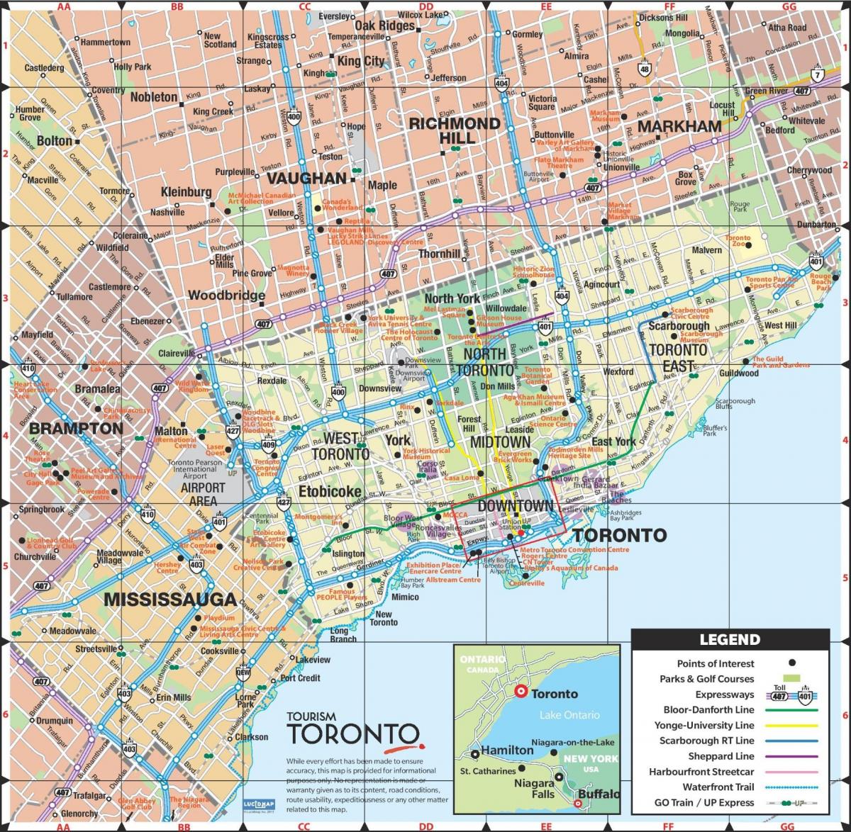
Map of Toronto city. Toronto map (Canada) to print. Toronto map (Canada) to download. Toronto city covers an area of 630 square kilometres (243 sq mi), with a maximum north-south distance of 21 kilometres (13 mi) and a maximum east-west distance of 43 km (27 mi) as its shown in Toronto map. Toronto city has a 46-kilometre (29 mi) long waterfront shoreline, on the northwestern shore of Lake Ontario.
The city of Toronto is intersected by three rivers and numerous tributaries as its mentioned in Toronto map: the Humber River in the west end and the Don River east of downtown at opposite ends of the Toronto Harbour, and the Rouge River at the Toronto city eastern limits. The harbour was naturally created by sediment build-up from lake currents that created the Toronto Islands.
Toronto climate is moderate for Canada owing to its southerly location within the country (see Toronto map). Toronto has a humid continental climate (Köppen Dfa), with warm, humid summers and cold winters. The city of Toronto experiences four distinct seasons, with considerable variance in day to day temperature, particularly during the colder weather season. Owing to urbanization and its proximity to water, Toronto has a fairly low diurnal temperature range (day-night temperature difference).
Toronto is a city of high-rises, having 1,800 buildings over 30 metres (98 ft), second only to New York City (which has over 5,000 such buildings) in North America as you can see in Toronto map. Most of Toronto buildings are residential (either rental or condominium), whereas the central business district contains the taller commercial office towers. There has been recent media attention given for the need to retrofit many of these buildings, which were constructed beginning in the 1950s as residential apartment blocks to accommodate a quickly growing population.
The many residential communities of Toronto express a character distinct from that of the skyscrapers in the commercial core. Victorian and Edwardian-era residential buildings can be found in enclaves such as Rosedale, Cabbagetown, The Annex, and Yorkville as its shown in Toronto map. Wychwood Park is historically significant for the architecture of its homes, and for being one of Toronto earliest planned communities. The Wychwood Park neighbourhood was designated as an Ontario Heritage Conservation district in 1985. The Casa Loma neighbourhood is named after Casa Loma, a storybook castle built in 1911 complete with stunning gardens, multiple turrets, massive stables, an elevator, secret passages, and bowling alleys. Spadina House is a 19th century manor that is now a museum.


