search
High park map Toronto
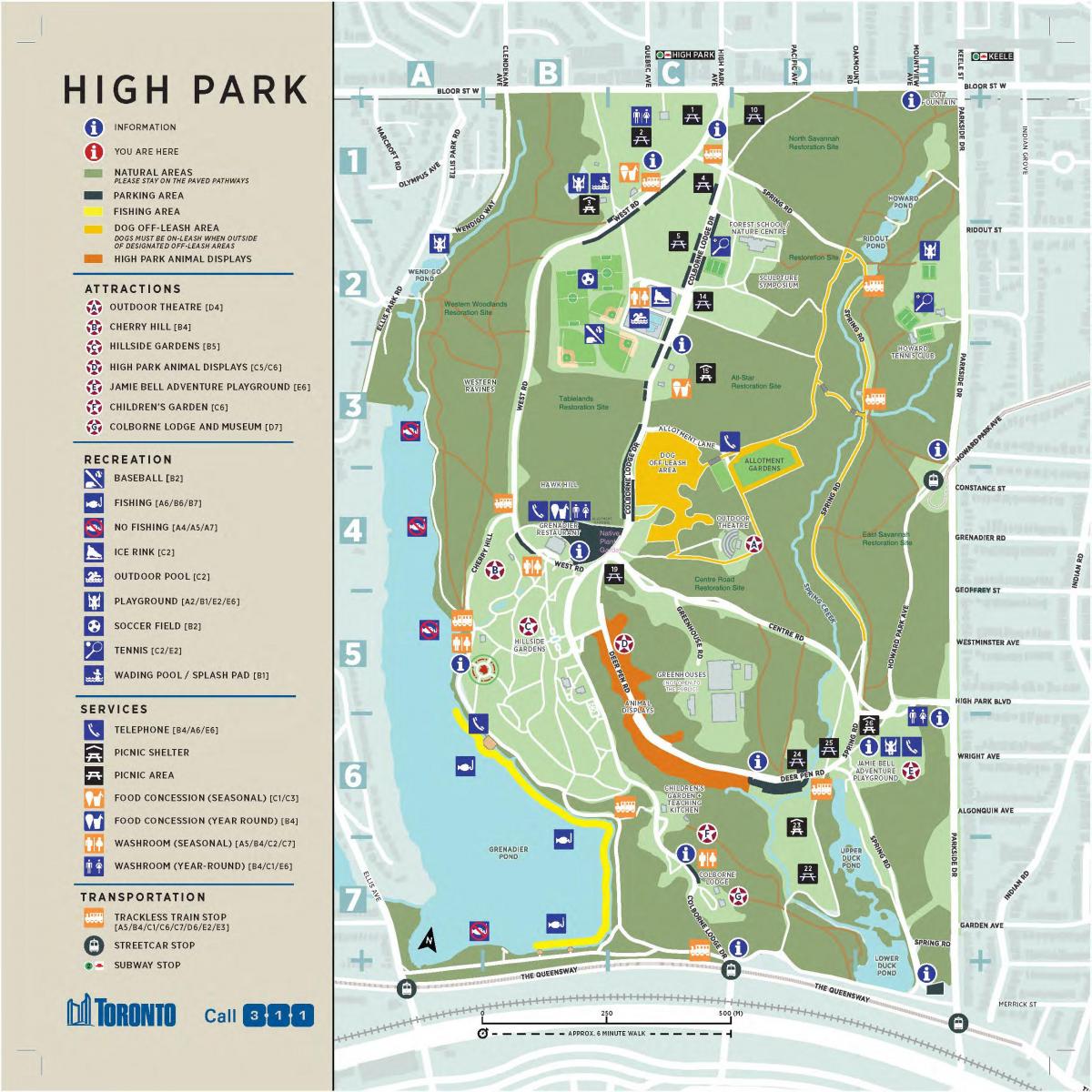
High park map. High park map Toronto (Canada) to print. High park map Toronto (Canada) to download. High Park is located in the west end of Toronto Canada. It encompasses 399 acres, bounded by Bloor Street West to the north, Parkside Drive to the east, the Queensway to the south, and Ellis Avenue/Ellis Park Road to the West. There are two main entrances to the Park: High Park Avenue and Bloor Street West High Park Boulevard and Parkside Drive
Tips for people visiting from the far east/west end of the GTA: Park at Kipling or Kennedy subway stations - parking is free on the weekends - and take the subway to High Park station. This saves time and frustration due to traffic and your parking spot is guaranteed. Parking can be hard to come by on busy days in the park.
Today, with its accessible location, natural features and diverse facilities, High Park continues to attract a multitude of visitors. As the population of Toronto grows and outdoor recreational activities such as running, cycling, dog walking, photography and nature study become more popular, the responsible stewardship of this valuable resource will continue to be a challenge in the years ahead.
High Park is a wonderful 400 acre park just north of the lakeshore and Sunnyside Beach. There are lovely gardens, little bridges, ponds, and waterfalls, and some more secluded trails. The best way to explore High Park is to start at the Bloor Street entrance and run along until you come across a little foot path or single track jetting off the main route.


