
search
Old Toronto map
Old map of Toronto. Old Toronto map (Canada) to print. Old Toronto map (Canada) to download. The former City of old Toronto refers to Toronto, Ontario, Canada, as it existed before the "megacity" amalgamation of 1998. Toronto was first incorporated as a city in 1834 (see old Toronto map) and its boundaries had last been extended in 1967. Old Toronto is sometimes referred to as the "South" or "Central" district; terms such as "the downtown core" are sometimes used, but these may also refer to a much smaller area at the heart of the old city.
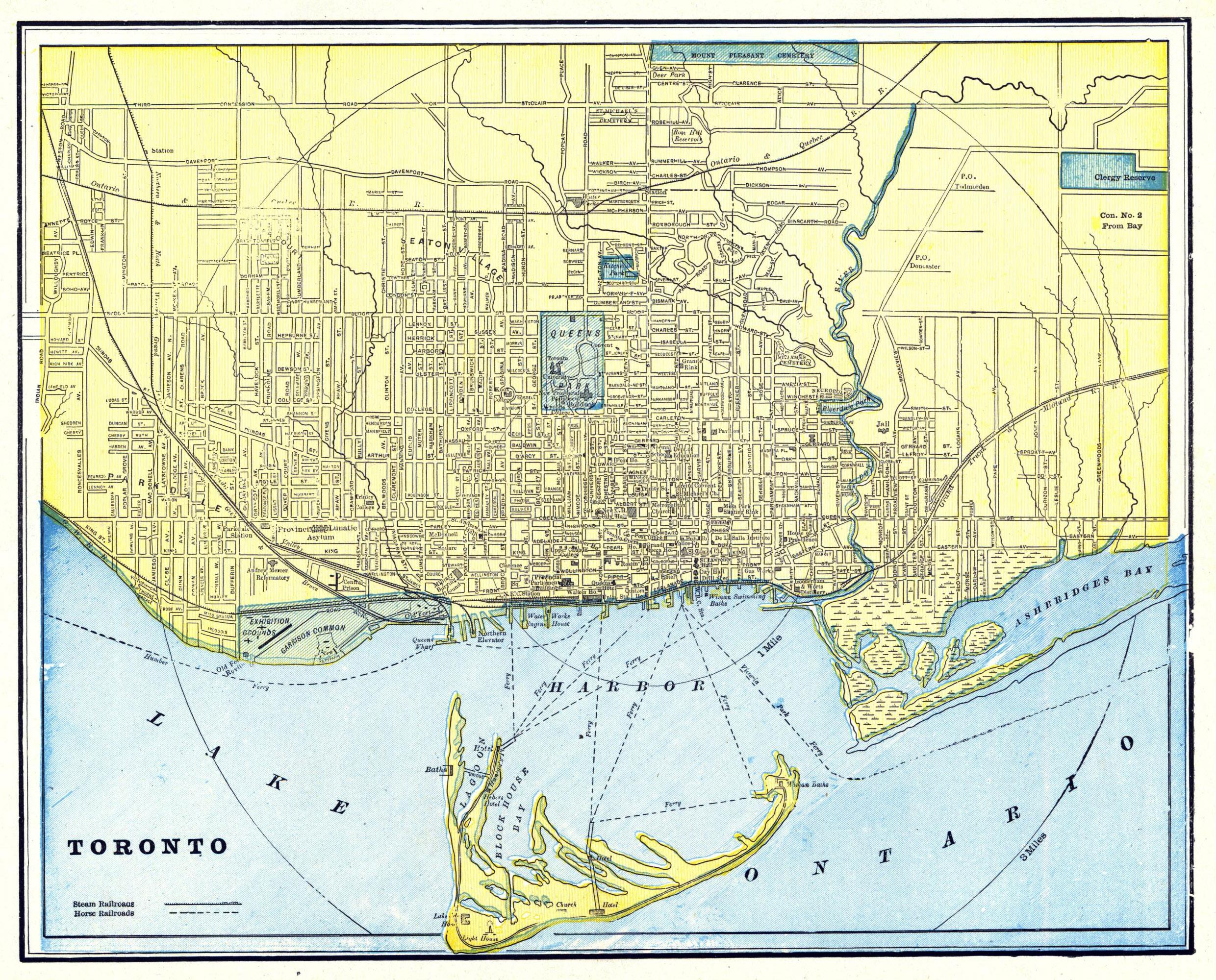
The old city is also called Old Toronto, but this term has historically referred to Toronto boundaries before the Great Toronto Fire of 1904, when much of city development was to the east of Yonge Street as its shown in old Toronto map, as opposed to 20th century development which tended to extend the old city westward, leaving the east side underdeveloped; a trend which is only being significantly reversed in the first decade of the 21st century.
Many old Toronto wards were recreated or branded to reconnect the areas with its past history, early beginnings, or even recent use and prominence. Some historical city "wards", considered neighbourhoods at one time, are no longer used for neighbourhood distinction as they once were; for example, St. George and St. Patrick wards as its mentioned in old Toronto map. In 2001, the old City of Toronto population was 70% White, 10% Chinese, 5% Black, 5% South Asian, 3% Filipino, 2% Latin American, 2% Southeast Asian, 1% Korean, and 2% Other.